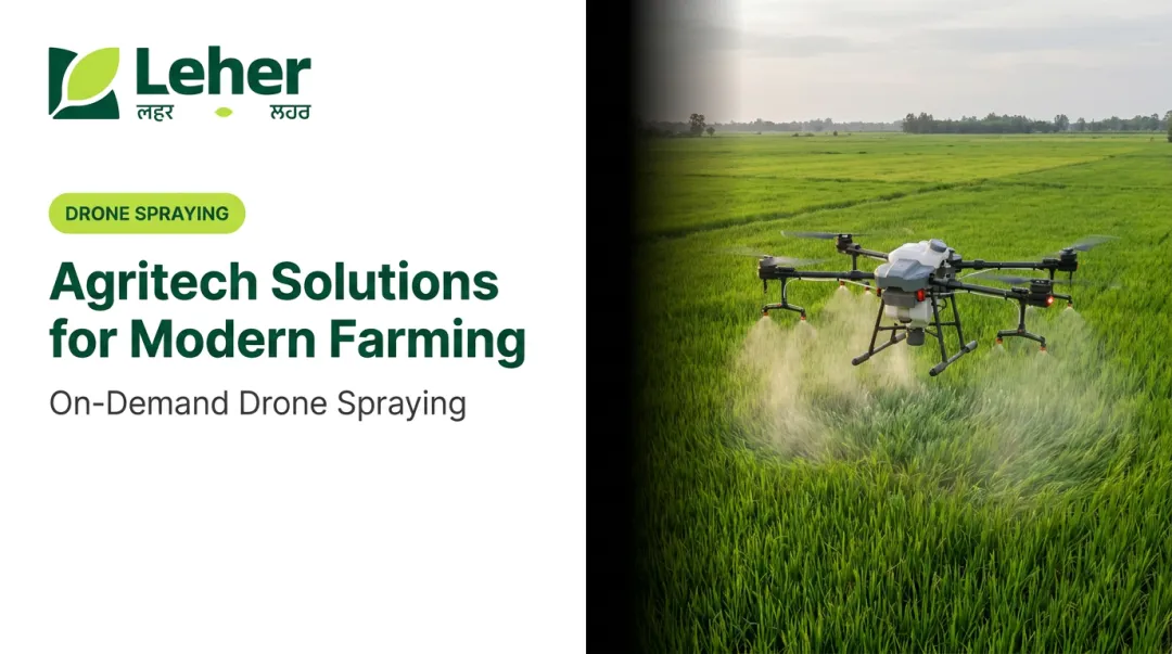
Introduction: India's Farms Are Thirsty — And Drones Are Changing That
Indian agriculture accounts for over 90% of the country's total freshwater withdrawals, yet a vast portion of that water never reaches the crop root zone. Flood irrigation runs off. Manual sprayers over-apply. Farmers can't physically inspect every corner of a 20-acre field for blocked drip lines or waterlogged patches.
Meanwhile, groundwater is running out fast. Punjab's extraction rate has hit 163.76% of recharge capacity. Haryana sits at 135.74%. Rajasthan at 148.77%. These aren't projections — they're current figures from the Central Ground Water Board's 2023 assessment.
The response can't wait for large-scale infrastructure reform. Farm-level solutions are needed now. Drone technology has moved from experimental to actively deployed across India: not just for crop scouting, but specifically for how water is used, monitored, and applied.
This article covers how drones detect water stress, enable precision spraying, and support smarter irrigation decisions — with practical context for Indian farmers ready to act.
Key Takeaways
- Agriculture uses over 90% of India's freshwater, and groundwater is critically over-extracted in Punjab, Haryana, and Rajasthan
- Drone precision spraying uses as little as 8 litres per acre versus 26+ litres with a knapsack sprayer, cutting carrier-fluid use by roughly 70%
- Thermal and multispectral sensors identify water stress zones before visible damage appears, enabling targeted irrigation decisions
- Most Indian farmers access drone services through providers like Leher with no equipment purchase required
- DGCA regulations govern all commercial drone operations, and compliance sits with the operator rather than the farmer
India's Farming Water Crisis: Why Traditional Methods Are Failing
The Numbers Behind the Problem
A 2021 Science Advances study projects that groundwater depletion could reduce India's winter cropped area by up to 20% nationally — and up to 68% in the most depleted regions. Agriculture already draws 87% of India's total annual groundwater extraction, equal to roughly 209.74 billion cubic metres per year.
The states most exposed — Punjab, Haryana, Rajasthan — are also the country's most productive farming belts. This is the core tension: the regions feeding India are draining their aquifers fastest.
Why Conventional Methods Make It Worse
Traditional irrigation and spraying practices accelerate the problem in several ways:
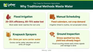
- Flood irrigation achieves only 25–35% water-use efficiency, meaning 65–75% of applied water is lost to runoff, evaporation, or deep percolation
- Manual scheduling relies on guesswork — farmers often irrigate on fixed calendars rather than crop demand signals
- Knapsack and tractor sprayers use 26+ litres of water per acre as a carrier fluid, compared to 8 litres with drone spraying
- Ground-level inspection cannot detect stressed zones early — by the time a farmer walks a field and spots wilting, yield loss has already started
Why Now Is the Right Moment for Drones
These inefficiencies aren't just persistent — they're getting harder to sustain as aquifer levels drop. The good news is that three conditions now make drone-based alternatives genuinely accessible:
- Service costs have fallen: Per-acre drone spraying is now viable for smallholders, not just large commercial farms.
- Policy support is in place: Kisan Drone subsidies and the Namo Drone Didi scheme offer up to ₹8 lakh for women's SHGs, reducing the barrier to adoption.
- Real-field results back it up: Early adopters across India have documented measurable reductions in water use and input costs — not lab projections.
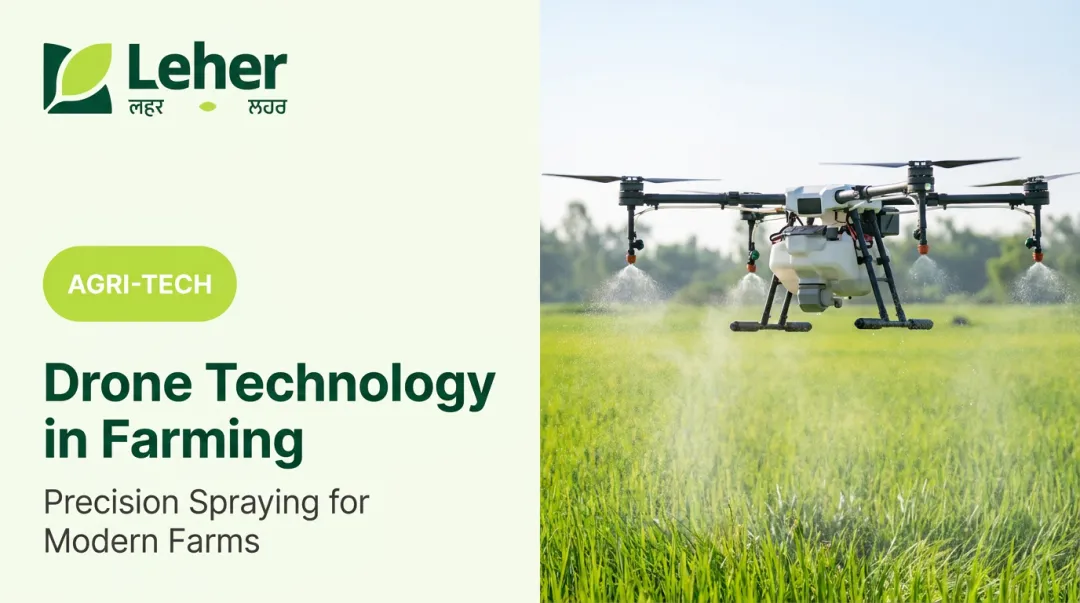
How Drone Technology Directly Addresses Agricultural Water Challenges
Thermal Imaging: Seeing Stress Before It Shows
When a plant is moisture-stressed, stomatal conductance drops, transpiration slows, and canopy temperature rises. Drones equipped with thermal cameras capture these temperature variations across an entire field in a single flight, identifying stressed zones days before visible wilting appears.
Catching stress early changes intervention timing entirely. A targeted irrigation response replaces emergency flooding of a whole field.
Multispectral and NDVI Mapping
Multispectral sensors capture crop data beyond what the human eye sees. The Normalised Difference Vegetation Index (NDVI), calculated as (NIR − Red) / (NIR + Red), reveals which zones are genuinely water-deficient versus adequately irrigated.
Rather than treating a 50-acre field uniformly, farmers get a zone-specific prescription map — irrigate here, hold off there. Research from 2019 demonstrated that UAV multispectral systems can generate variable-rate irrigation maps by integrating vegetation indices with crop evapotranspiration data.
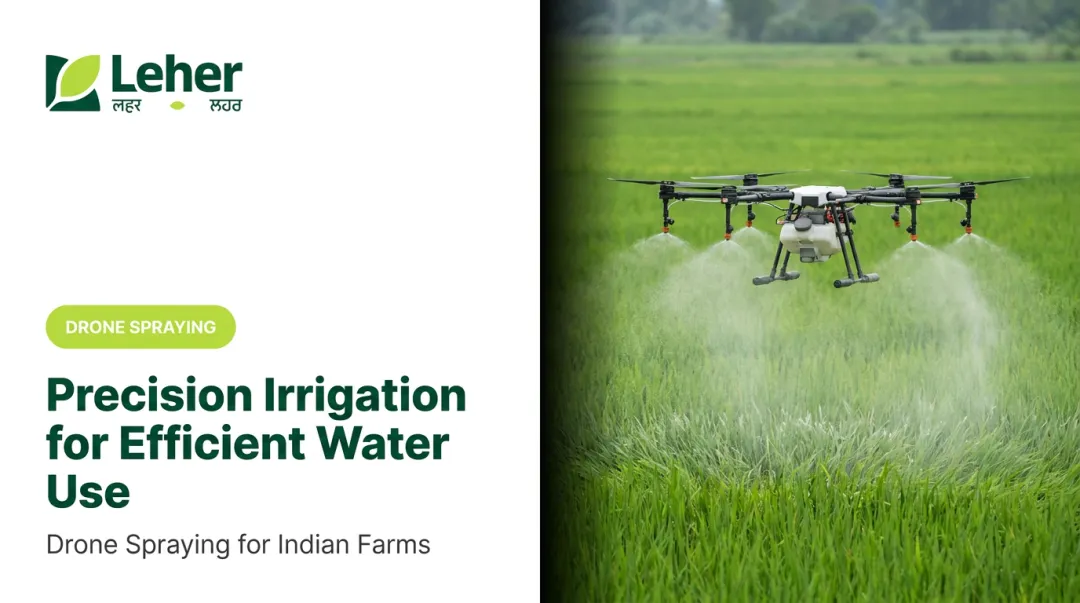
Precision Drone Spraying: Cutting Carrier Water
Once sensing identifies where inputs are needed, precision spraying delivers them with minimal waste. Drone sprayers fly at **1.5–3 metres above the crop canopy**, applying liquid in fine, controlled mists using centrifugal atomisation or similar nozzle technology — and this is where the biggest water savings materialise.
The results from Indian field trials are specific:
| Method | Application Rate | Unit |
|---|---|---|
| Conventional knapsack sprayer | 26.67 litres | Per acre |
| Agricultural drone | 8 litres | Per acre |
| ICAR potato trial (drone) | 20 litres (vs. 500–750 litres conventional) | Per hectare |
These are carrier-fluid savings (water used to dilute and deliver pesticides or fertilisers, not irrigation water). Across a typical Indian farm running multiple spray cycles per season, switching to drone application can reduce total spray-water demand by over 70%.
Real-Time Monitoring Loops
When drone flight data feeds into a farm management system, farmers can move from reactive to forward-looking water management. Typical monitoring loops enable:
- Tracking irrigation uniformity across field zones after each flight
- Flagging anomalies (dry patches, over-irrigated areas) before the next application
- Adjusting delivery schedules based on NDVI or thermal trends
- Building a seasonal record that informs future irrigation planning
For smallholder farmers managing multiple plots, this kind of data continuity reduces guesswork and cuts water applied to areas that don't need it.
Key Drone Applications for Water Management in Indian Agriculture
Irrigation Monitoring and Scheduling Support
Recurring drone flights — weekly or fortnightly — build a time-series record of how water moves through a field. Farmers can identify which sections are consistently under- or over-irrigated, then adjust pump schedules or drip network layouts accordingly.
That scheduling precision matters most at scale. For large farms in water-stressed districts, physical inspection of every zone is impractical — a drone flight covers the same ground in minutes, surfacing problems that manual walkthroughs often miss entirely.
Precision Spraying to Eliminate Water Overuse
Precision drone spraying has demonstrated up to 90% reduction in water usage compared to traditional methods. Leher's service delivered this across 6,500+ acres and 810+ farmers in 2024 alone — cumulatively covering 30,000+ acres and 2,100+ farmers through 100+ drone partners.
Crop coverage spans:
- Sugarcane, paddy, cotton, wheat, and vegetables
- Tea — 700+ hectares sprayed
- Rubber — 1,000+ hectares sprayed
Each acre takes roughly 5 minutes to spray, with a single drone covering up to 50 acres per day.
Farmers book through the Leher App in three steps — no upfront equipment investment required.
Waterlogging and Flood Stress Detection
After heavy rainfall or irrigation overflow, drone cameras can rapidly map waterlogged zones across a field. This helps farmers:
- Prioritise drainage intervention before root damage sets in
- Protect standing crops by identifying the extent of saturation
- Avoid re-irrigation in areas that are already waterlogged — a common and costly mistake
UAV imagery has been used in research settings to estimate crop injury from flooding stress, though large-scale, India-specific field data is still being compiled.
What Indian Farmers Should Know Before Adopting Drone Technology
India's DGCA Regulatory Framework
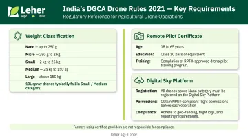
The Ministry of Civil Aviation's Drone Rules, 2021 govern all commercial drone operations in India. Key requirements include:
- Weight classification: Nano (≤250g), Micro (>250g–2kg), Small (>2–25kg), Medium (>25–150kg), Large (>150kg) — most 10-litre spray drones fall in the Small or Medium category depending on all-up take-off weight
- Remote Pilot Certificate: Operators must be 18–65 years old, have passed Class 10, and complete training from a DGCA-authorised Remote Pilot Training Organisation (RPTO)
- Digital Sky Platform: Drone registration, flight permissions, and operational compliance are managed through the Digital Sky portal
Farmers accessing drone services through a provider don't need to manage this themselves — it's the operator's responsibility. But knowing the framework helps when evaluating which service providers are genuinely compliant.
Service Model vs. Ownership Model
For most Indian farmers (particularly smallholders), buying a drone outright is not the entry point. A DGCA-certified 10-litre agricultural spray drone can cost anywhere from ₹5.5 lakh to ₹8 lakh depending on brand, payload, batteries, and accessories. That's a steep upfront cost when margins are already thin.
The more practical route: access drone spraying as a service, paying per acre after the job is done.
What to look for in a drone service partner:
- DGCA-certified pilots (check that pilots hold valid Remote Pilot Certificates)
- DGCA-approved drone models in the fleet
- Transparent per-acre pricing with no hidden fees
- Coverage in your district or region
- Track record across your crop type
A service that checks all these boxes removes the biggest barriers to adoption. Leher is built around this approach: farmers book through the Leher App, a certified pilot arrives at the farm, completes the spray session, and payment happens only after the job is done — no equipment to buy, no regulatory paperwork for the farmer.
Frequently Asked Questions
Frequently Asked Questions
How do drones help in irrigation management on farms?
Thermal and multispectral drone sensors detect irrigation gaps, moisture-stressed zones, and waterlogged areas before visible symptoms appear. Farmers use this data to adjust pump schedules, fix blocked drip lines, and apply water by zone — rather than uniformly across the field.
How much water can drone spraying save compared to traditional methods?
In Indian field trials, drone sprayers used approximately 8 litres per acre versus 26+ litres with knapsack sprayers. ICAR's potato spraying data shows 20 litres per hectare by drone against 500–750 litres by conventional methods. These are carrier-fluid savings on spray applications, not irrigation water.
What is the price of a 10-litre agriculture drone in India?
Indicative prices for 10-litre agricultural spray drones range from roughly ₹5.5 lakh to ₹8 lakh, depending on brand, payload configuration, batteries, and accessories. Most Indian farmers find it more practical to book spraying through a per-acre service provider — platforms like the Leher App connect farmers directly with DGCA-certified pilots, with no equipment purchase required.
What is the best drone for farming?
Multispectral drones suit irrigation analysis and crop monitoring; dedicated spray drones (DJI Agras, Marut, and others) suit precision input application. For most Indian farmers, booking through a certified service provider — such as through the Leher App — is the most practical and cost-effective route.
What drone can land on water?
Standard agricultural drones are not designed to land on water. Certain amphibious UAV prototypes exist for specific aquatic monitoring applications. For farm water management, agricultural drones fly over water bodies or waterlogged fields to collect sensor and imagery data — no landing required.
Are agricultural drones legal to use in India?
Yes. Agricultural drones are legal in India under the Drone Rules, 2021. Operators must register their drones, hold valid Remote Pilot Certificates issued by a DGCA-authorised RPTO, and obtain appropriate flight permissions through the Digital Sky platform. Farmers using certified service providers do not need to manage this compliance themselves.