Introduction
Indian farmers collectively lose between 15–25% of their crop yields every season to pests, diseases, nematodes, and weeds — damage worth ₹0.9–1.4 lakh crore annually, according to CEEW. Much of this loss is preventable. The problem isn't the absence of solutions — it's that most farmers detect crop stress only after it has already spread across their fields.
Traditional ground-level scouting is slow, subjective, and covers only a fraction of any field per visit. By the time a farmer spots yellowing leaves or pest damage on foot, the problem is rarely contained to a single patch.
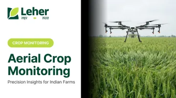
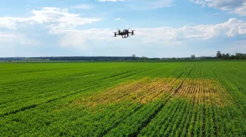
Aerial crop monitoring with drones gives farmers something ground scouting never could: a complete, timely picture of the entire field. Plant health data, stress zones, and problem patches become visible before damage spreads — shifting farmers from reactive damage control to early intervention.
What follows is a practical breakdown of how aerial crop monitoring works, the technology behind it, and why it matters for Indian farming conditions.
Key Takeaways
- Aerial crop monitoring uses drones with cameras and sensors to map entire fields and detect stress before it's visible on the ground
- Five steps drive the workflow: mission planning, data collection, image processing, analysis, and targeted intervention
- NDVI maps from multispectral sensors flag nutrient deficiency, water stress, and early disease weeks before visible symptoms appear
- Small plot sizes common across India are well-suited to multirotor drones; app-based booking removes the need to own or operate equipment
- Targeted interventions guided by aerial data can reduce pesticide use by up to 30% compared to broadcast spraying
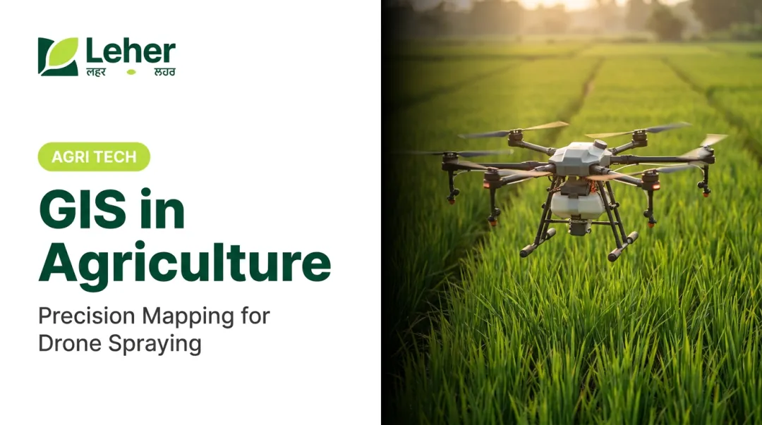
What Is Aerial Crop Monitoring?
Aerial crop monitoring is the practice of flying drones equipped with cameras and sensors over agricultural fields to collect high-resolution data on crop health, soil conditions, and field variability — then using that data to make faster, more precise farming decisions.
Ground-level scouting has real limitations at scale:
- Covers only a small sample of any field per visit
- Highly dependent on the observer's experience and attention
- Almost always reactive — problems get spotted after they've already spread
- Physically exhausting and time-consuming across fragmented plots
Drones solve the coverage problem. A single flight session can map hundreds of acres and return data that no walking inspection could match.
What Aerial Data Actually Captures
Different sensors collect different types of information:
- RGB imagery — visible-light photos showing crop colour, stand density, and obvious stress symptoms
- NDVI maps — a vegetation index derived from multispectral cameras that quantifies plant health by measuring how plants reflect near-infrared light; healthy plants reflect more, stressed plants reflect less
- Thermal imaging — detects surface temperature anomalies linked to water stress or fungal disease
- DSM/elevation models — digital surface models that reveal drainage patterns, waterlogging zones, and terrain variation
According to MicaSense's agricultural indices guide, NDVI data correlates with plant vigour, soil water availability, foliar nutrient content, and yield potential — giving farmers a direct basis for variable-rate input decisions, targeted scouting, and early intervention before stress spreads.
That agronomic value is driving rapid adoption. The global agricultural drone market stood at $2.63 billion in 2025 and is projected to reach $10.76 billion by 2030 at a 32.6% CAGR — growth concentrated heavily in Asia, where smallholder farm density makes aerial monitoring particularly cost-effective.
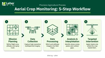
How the Aerial Crop Monitoring Process Works
Aerial crop monitoring follows a structured five-step workflow, from pre-flight planning through to on-ground action.
Step 1 — Mission Planning
Before any flight, the operator defines the field boundary, sets automated flight paths for complete coverage, selects the sensor payload, and determines altitude and image overlap ratio based on the resolution needed. Software platforms like DroneDeploy handle this planning automatically once field boundaries are uploaded.
Step 2 — Data Collection
The drone flies autonomously over the field, capturing hundreds of overlapping images using RGB, multispectral, or thermal cameras depending on the objective. Coverage varies by drone type and payload — multispectral-equipped agricultural drones commonly used in India can cover 50–150 hectares per flight under standard operating conditions.
Step 3 — Data Processing
Captured images are stitched together using photogrammetry software to produce:
- Orthomosaic maps — georeferenced, stitched aerial images of the full field
- NDVI and vegetation index maps — showing plant health variation across the field
- DSMs — 3D elevation models for drainage and terrain analysis
Platforms like Pix4Dfields handle this processing automatically after images are uploaded.
Step 4 — Analysis and Interpretation
Agronomists or AI-driven platforms interpret the processed maps to identify problem zones — areas with low vegetation index scores, unusual heat signatures, or uneven crop stand. The output is a location-specific report showing where in the field intervention is needed and what type of stress is likely present.
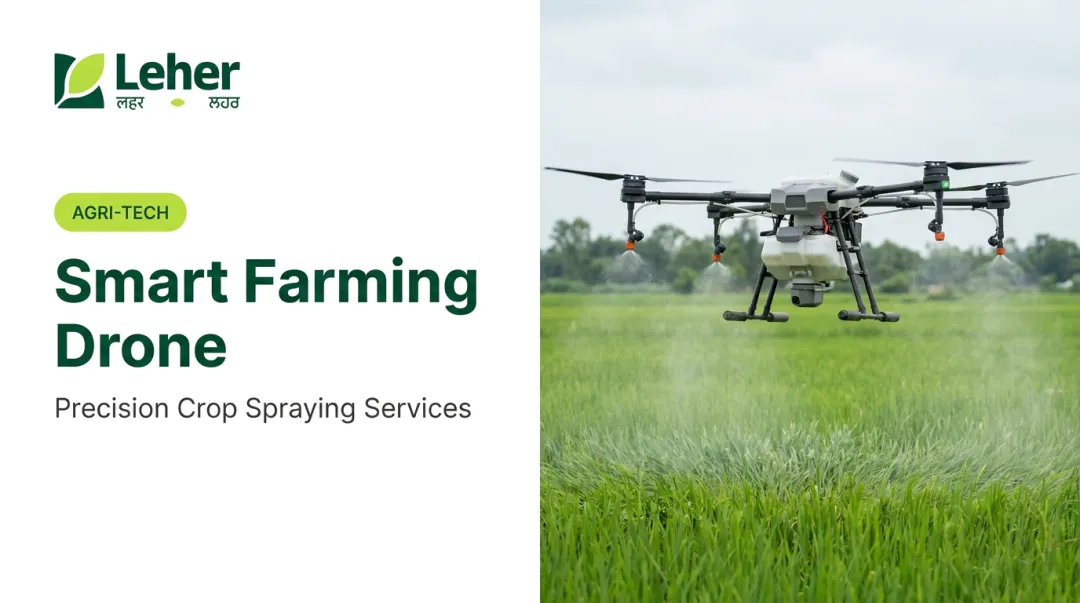
Step 5 — Intervention
This is where monitoring translates to action. Aerial data guides:
- Targeted pesticide spraying in affected zones only
- Irrigation adjustments to water-stressed patches
- Variable-rate fertiliser application based on soil variability data
Leher's drone spraying services follow this same logic: field-level data determines exactly where inputs are applied, so nothing is wasted on areas that don't need treatment.
Key Applications of Aerial Crop Monitoring
Crop Health and Stress Detection
Multispectral cameras detect subtle variations in chlorophyll and light reflectance that indicate nutrient deficiency, drought stress, or early-stage disease — often well before any symptoms are visible at ground level. Catching problems early is far cheaper and more effective than responding after infection spreads.
Research into rice leaf blast, for instance, demonstrates that UAV remote sensing combined with spectral vegetation indices can detect disease earlier than ground inspection alone — enabling farmers to apply fungicides to specific zones before infection spreads across the field.
Key stress indicators aerial monitoring can flag:
- Low NDVI zones indicating nitrogen deficiency or poor root development
- Irregular reflectance patterns consistent with fungal or bacterial infection
- Thermal anomalies pointing to water stress or disease-related wilting
- Uneven canopy density revealing poor germination or seedling mortality
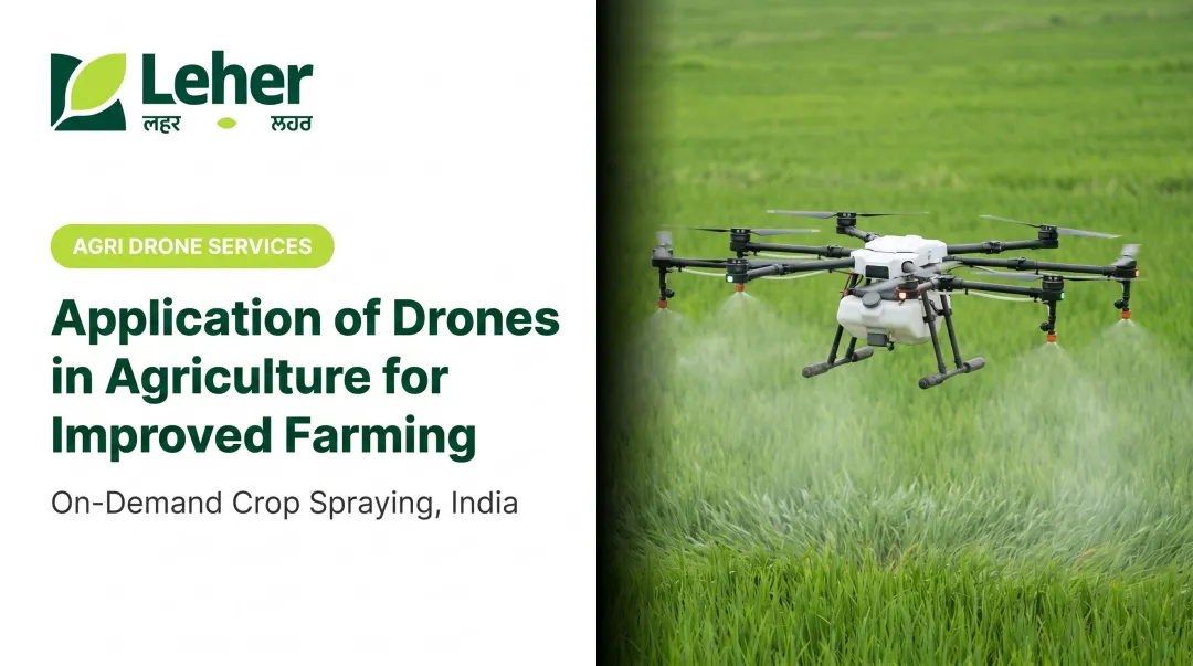
Pest and Disease Identification
Thermal imaging and NDVI analysis work together to flag pest hotspots and infection zones. Plants under pest or pathogen attack typically exhibit measurable changes in both surface temperature and light reflectance before visible symptoms develop — changes that multispectral and thermal sensors can detect from above.
The practical value is targeted intervention rather than blanket treatment. When aerial data pinpoints the affected 10% of a field, pesticides are applied there — not across the remaining 90%. Research from UF/IFAS Extension indicates that targeted drone-based spraying can reduce chemical use by up to 30% compared with traditional broadcast application.
For Indian farmers, this translates directly to lower input costs. Leher's spatially guided spraying service — booked through the Leher App — applies this same logic, directing pilots to treat only the zones that need it.
Field Mapping and Soil Analysis
Drones create high-resolution orthomosaic maps and elevation models that reveal information critical for long-term field management:
- Drainage patterns — identifying waterlogging risk zones before planting
- Soil texture variability — guiding variable-rate fertiliser application
- Uneven crop stand — revealing poor seed-soil contact or germination failure
- Terrain elevation — supporting irrigation layout planning
A 2025 study in Agriculture demonstrated that drone-derived elevation models can proactively identify problematic drainage areas — the kind of data that helps farmers plan rather than react.
Yield Estimation and Harvest Planning
Repeat aerial surveys at different crop growth stages allow farmers to track canopy development, estimate biomass, and generate yield predictions. Studies across rice, wheat, sugarcane, and cotton have demonstrated that UAV-derived vegetation indices correlate with final grain yield — letting farmers make informed decisions about:
- Labour allocation for harvest
- Storage capacity planning
- Market timing and sale negotiations
For crops like paddy and wheat — central to Indian smallholder agriculture — yield estimates generated 4–6 weeks before harvest can meaningfully improve planning.
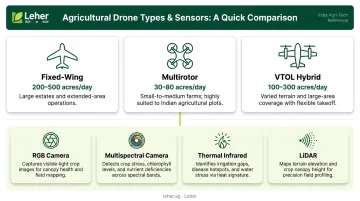
Types of Drones and Sensors Used for Aerial Crop Monitoring
Drone Categories
| Drone Type | Coverage Capability | Best Fit for India |
|---|---|---|
| Fixed-wing | Up to 500 ha per flight (senseFly eBee X) | Large estates, agribusiness, research farms |
| Multirotor (quadcopter/hexacopter) | Up to 200 ha per flight (DJI Mavic 3M) | Small-to-medium farms; FPO/CHC service use |
| VTOL hybrid | 460–550 ha per flight (WingtraOne GEN II) | Varied terrain, large contiguous areas |
Given that 68.5% of Indian operational holdings are marginal plots under 1 hectare (Agriculture Census 2015-16), multirotor drones are the most practically relevant category for most Indian farmers. They're the standard choice whether a farmer is flying their own unit, pooling resources through an FPO, or booking through an on-demand drone service.
The drone type determines coverage; the sensor determines what data you actually collect.
Sensor Types
- RGB cameras — Standard visible-light imaging for crop stand assessment, visual scouting, and field records
- Multispectral cameras — Compute vegetation indices (NDVI, NDRE, EVI, SAVI) that quantify plant health beyond what the eye can see
- Thermal infrared cameras — Detect surface temperature anomalies linked to water stress, disease, or irrigation failure
- LiDAR — Generates precise 3D terrain models for drainage analysis and elevation mapping on larger farms
The right drone-sensor combination depends on farm size, crop type, monitoring objective, and budget. For most smallholders, this makes on-demand drone services the practical path — the operator arrives with the right equipment for the job, and the farmer pays only for what was done.
Benefits and Challenges of Aerial Crop Monitoring for Indian Farmers
Core Benefits
- Speed — A single drone session maps in hours what would take days on foot
- Early detection — Stress identified before visible symptoms means cheaper, more effective intervention
- Input efficiency — Targeted application reduces pesticide, water, and fertiliser waste
- Yield predictability — Repeat surveys support harvest planning and market timing
- Safety — Reduces farmer exposure to agrochemicals during application
Real Challenges
- Equipment cost — Agriculture spraying drones cost roughly ₹4–5 lakh for Indian-made models; monitoring-capable multispectral setups add further cost
- DGCA compliance — Commercial drone operations require Digital Sky registration, UIN, type certification, and RPTO-trained remote pilots with a valid licence
- Data interpretation — Orthomosaic maps and NDVI outputs require agronomic knowledge or software support to act on
- Connectivity — Cloud-based processing platforms require reliable data connectivity, which remains uneven in rural India
How the Service Model Addresses These Barriers
For most Indian smallholders, individual ownership is neither practical nor necessary. The service-based model sidesteps the key barriers directly:
- Farmers book drone services through platforms like the Leher App without purchasing equipment
- DGCA-certified pilots handle all compliance, licensing, and operational requirements
- Processing and basic interpretation can be handled by the service provider
- Pay-after-service models eliminate upfront financial risk
India's policy environment backs this approach. The Namo Drone Didi scheme is deploying 15,000 drones through women's SHGs for rental services to farmers, with 80% central assistance capped at ₹8 lakh. Custom Hiring Centres and FPOs are also provisioned to offer drone services on a rental basis — adding more access points for farmers who have never owned equipment and never need to.
Frequently Asked Questions
What is aerial crop monitoring?
Aerial crop monitoring uses drones equipped with cameras and sensors to collect data on crop health, soil conditions, and field variability from above. It enables farmers to detect problems like nutrient deficiency, pest pressure, or water stress early and make targeted, data-driven decisions rather than reacting after damage has spread.
What is the crop monitoring process?
The process follows five steps:
- Mission planning — defining flight paths and selecting sensors
- Autonomous drone data collection over the field
- Image processing into orthomosaic and vegetation index maps
- Analysis to identify problem zones
- Targeted intervention guided by field data, whether ground-based or drone-applied
What types of drones are used for aerial crop monitoring?
Three main types are used: fixed-wing drones for large-scale coverage, multirotor drones for small-to-medium farms and precision work, and VTOL hybrids that combine range with vertical takeoff. For most Indian farm sizes, multirotor drones are the most practical choice.
What sensors are used in aerial crop monitoring?
The four most common sensors are:
- RGB cameras — visual mapping and crop stand assessment
- Multispectral cameras — NDVI and plant health indices
- Thermal infrared cameras — water stress and disease detection
- LiDAR — 3D terrain and drainage mapping
Is aerial crop monitoring suitable for small farms in India?
Yes. Multirotor drones are well-suited to the small plot sizes typical of Indian agriculture, and drone-as-a-service models mean farmers access aerial monitoring without purchasing equipment. Services booked through the Leher App require no capital investment — farmers pay only after the job is done.