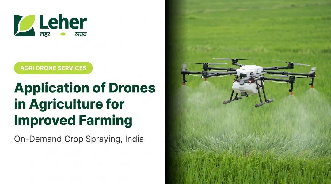
Enter smart farming drones. These unmanned aerial vehicles (UAVs) are more than just flying cameras; they are sophisticated data-gathering tools that are shifting the paradigm from manual guesswork to data-driven precision. This article explores what these drones are, the tangible benefits they offer, their key applications, and the incredible opportunities they are creating for Indian farmers and rural entrepreneurs.
TL;DR: How Drones are Transforming Indian Farming
- Better Yields & Crop Health: Drones provide precise data for monitoring crop health, enabling timely interventions that protect yields.
- Optimised Resources: They facilitate targeted application of water, fertilisers, and pesticides, reducing waste significantly.
- Data-Driven Decisions: High-resolution maps and sensor data empower farmers to make informed choices about soil, water, and pest management.
- New Economic Pathways: The "Drones-as-a-Service" model is creating a new class of rural entrepreneurs who provide drone services to local farmers.
What Are Smart Farming Drones and How Do They Work?
A smart farming drone is an unmanned aerial vehicle (UAV) equipped with technology like cameras, GPS, and advanced sensors to perform agricultural tasks like precision spraying or crop monitoring. Think of it as a highly intelligent farmhand that can see, measure, and act with incredible accuracy from above.
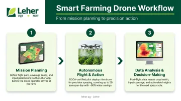
The process is straightforward and typically follows a three-step workflow:
- Mission Planning: A trained, DGCA-certified pilot uses specialised software on a tablet or laptop to plot an automated flight path over the field. This map tells the drone exactly where to fly and what to do.
- Autonomous Flight & Action: The drone takes off and flies the pre-planned route on its own. As it flies, it performs a specific task like precision spraying of fertilisers and pesticides, or it collects data using cameras to assess crop health.
- Data Analysis & Decision-Making: When data is collected, it is processed by software to create insightful maps. A crop health map, for example, can show a farmer exactly which parts of their field are under stress, guiding targeted action instead of treating the entire field the same.
Underpinning this entire process are a few key components: a flight controller (the drone's brain), a highly accurate GPS module for navigation, and a payload of various sensors or sprayers depending on the mission.
The Top 5 Benefits of Using Drones in Indian Agriculture
Drones offer a powerful combination of efficiency, cost savings, and sustainability that directly addresses many of the challenges Indian farmers face today.
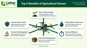
1. Boost Crop Yields and Quality
One of the biggest advantages of drones is their ability to see what the human eye cannot. By using sensors that capture light beyond the visible spectrum, drones can detect early signs of stress from pests, diseases, or nutrient deficiencies long before they become visible.
This is often done using NDVI (Normalized Difference Vegetation Index) sensors, which create detailed "health maps" of the field. These maps use colour codes to highlight areas of stressed or unhealthy vegetation.
With this information, farmers can intervene quickly and precisely, preventing small problems from devastating an entire crop and ultimately protecting their yield potential.
2. Drastically Reduce Water and Chemical Usage
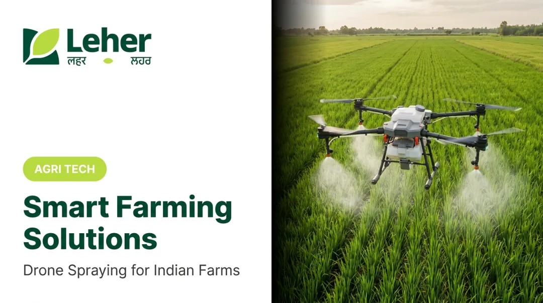
Traditional spraying methods often involve blanketing an entire field with water and chemicals, leading to significant waste and environmental runoff. Drones enable a far more intelligent approach called precision spraying.
By targeting only the specific areas identified as needing treatment, drones ensure that expensive inputs are used only where necessary. This targeted approach can reduce pesticide use by up to 30% and water consumption for spraying by up to 90%, according to our internal data at Leher. The Government of India backs this up, with a PIB report stating that Kisan Drones can save 80% to 90% of water.
3. Enhance Farm Efficiency and Save Time
The speed and scale of drone operations dramatically improve efficiency. A single drone can survey hundreds of acres in a day, a task that might take a person weeks to complete on foot. This allows farmers to monitor larger areas more frequently and with greater accuracy.
Consider the difference: checking the health of a 50-acre wheat field could take a farmer two full days of walking. A drone can complete the same task in under an hour. Official reports confirm this, noting that drones can spray at least 10 times more area per day than a worker with a traditional knapsack sprayer.
4. Improve Soil and Field Management
Drones are not just for monitoring crops; they are also excellent tools for understanding the land itself. By creating detailed 3D maps of the terrain, drones can reveal crucial information about elevation, slope, and drainage patterns.
This data is invaluable for strategic land preparation. Farmers can use these maps to plan more effective irrigation channels, identify areas prone to waterlogging after monsoons, and develop strategies to combat soil erosion, ensuring the long-term health and productivity of their land.
5. Increase Safety for Farm Workers
Farming can be hazardous work, and spraying pesticides is one of its riskiest tasks. Using drones eliminates the need for workers to have direct contact with potentially harmful chemicals.
It also removes the physical burden of carrying heavy backpack sprayers, often weighing over 15 kg, across uneven and difficult terrain for hours on end. By delegating this task to a machine, farmers can create a safer working environment for themselves and their staff.
Key Applications of Drones Across the Crop Cycle
Drones are versatile tools that provide value at every stage of farming, from pre-planting analysis to post-harvest assessment.
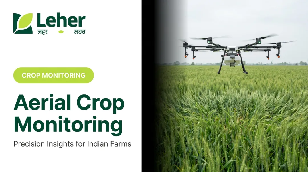
Crop Monitoring and Health Analysis
Using multispectral and hyperspectral sensors, drones capture data that reveals a plant's health, water stress levels, and nutrient content. This allows for a proactive approach to farming, where potential issues are identified and addressed before they impact the bottom line.
Precision Spraying of Fertilisers and Pesticides
This is one of the most impactful applications in India. After a drone creates a crop health map, that data can be used to generate a "prescription map." This map is then loaded into a spraying drone, which applies fertilisers or pesticides at a variable rate, delivering more to areas that need it and less to healthy areas.
This is the core of the "Drones-as-a-Service" model. Companies like Leher are pioneering this approach, providing farmers with access to advanced spraying technology that ensures every drop of input is used effectively, protecting both the environment and the farmer's profit margin.
Field Mapping and Surveying
Before planting, drones can create high-resolution orthomosaic maps of a field. These detailed, top-down images are essential for planning the season. They can be used for counting crops, assessing plant density after germination, and identifying problem areas that need attention.
Seeding and Reforestation
An emerging application for drones is planting seeds, particularly in areas that are difficult to reach on foot. Drones can be loaded with "seed bombs" (seeds encased in a ball of soil and nutrients) and deploy them rapidly over large areas, making them a powerful tool for reforestation projects.
Livestock Management and Security
On larger farms, drones with thermal cameras can transform livestock management and save countless hours of manual labour. Their key uses include:
- Locating animals: Quickly find missing livestock, even in difficult terrain.
- Monitoring herd health: Assess the condition of the herd from a safe distance.
- Checking infrastructure: Inspect the integrity of fences without manual patrols.
Choosing the Right Drone: Types and Technologies Explained
Agricultural drones are specialized for different tasks. The type of drone a certified pilot uses depends on the job, whether it's spraying a complex field or mapping hundreds of acres.
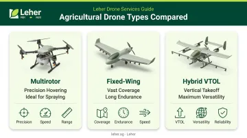
Types of Agricultural Drones
- Multirotor drones, like quadcopters and hexacopters, are the standard for precision spraying. Their ability to hover and navigate complex terrain makes them ideal for applying inputs exactly where needed.
- Fixed-wing drones resemble small aeroplanes and are built for speed and endurance. They excel at mapping and surveying vast areas efficiently but cannot hover for spot treatments.
- Hybrid VTOL (Vertical Take-Off and Landing) drones combine the benefits of both types. They take off vertically like a multirotor and fly long distances like a fixed-wing, offering maximum versatility.
Essential Sensors and Technologies
A drone's true value comes from its payload. The sensors it carries collect the data that informs crucial farming decisions.
- RGB cameras are standard high-resolution cameras used to create visual maps, scout for issues, and perform plant counts.
- Multispectral sensors capture light bands invisible to the human eye, such as near-infrared. This data is used to calculate vegetation indices (e.g., NDVI) to assess plant health and stress.
- Thermal sensors measure heat signatures to detect water stress in crops by identifying subtle variations in canopy temperature, pinpointing areas that need irrigation.
- LiDAR (Light Detection and Ranging) uses laser pulses to create highly accurate 3D terrain models, which are useful for analysing elevation and planning irrigation systems.
The Rise of the Agri-Drone Entrepreneur in India
Crucially, this advanced technology is becoming accessible to all farmers, not just large corporations. This is thanks to the "Drones-as-a-Service" (DaaS) model.
The DaaS model removes the need for individual farmers to make a large upfront investment in a drone, which can be a significant barrier. Instead, a local entrepreneur buys a drone and gets the required training and certification. They then offer spraying, mapping, and monitoring services to multiple farmers in their community for a simple per-acre fee.
This model is creating a powerful new ecosystem of rural entrepreneurship, a trend backed by government initiatives and a significant market opportunity. Some analysts estimate drone services in India could be worth around ₹300 billion by 2026.
This movement aligns perfectly with the vision of companies like Leher, which aims to empower a network of 1,000 rural drone partners by 2030. This approach creates skilled jobs and fosters economic growth in agricultural regions.
Frequently Asked Questions
What are drones for smart agriculture?
They are unmanned aerial vehicles (UAVs) equipped with sensors, cameras, and tools to help farmers collect data and perform tasks like spraying and monitoring. This improves crop health, optimises resource use, and increases overall efficiency.
What is the cost of a farming drone?
Costs range from a few lakhs for a basic drone to over ₹10-15 lakhs for advanced sprayers. For most farmers, the most cost-effective option is hiring a Drone-as-a-Service (DaaS) provider to pay on a simple per-acre basis.
How much land can a farming drone cover in one day?
This depends on the task. A spraying drone can typically cover 30-40 acres in a day, depending on the crop and field conditions. A fixed-wing mapping drone can survey over 100-200 acres in a single day.
What are the government regulations for flying agricultural drones in India?
Commercial drone operations require a certified pilot, a drone with a Unique Identification Number (UIN), and adherence to DGCA guidelines. Always check the latest rules on the official Digital Sky platform before flying.
Are drones effective for small farms in India?
Yes. While owning a drone can be expensive, the Drone-as-a-Service (DaaS) model is highly effective and affordable for small farms. It allows farmers to pay per-acre for services like spraying, getting all the benefits without the high cost of ownership.
What training is required to become a certified drone pilot in agriculture?
To operate a drone commercially, you must complete a course at a DGCA-approved remote pilot training organisation (RPTO), like the ones offered by Leher. This training is mandatory to obtain the Remote Pilot Certificate required for legal operations.