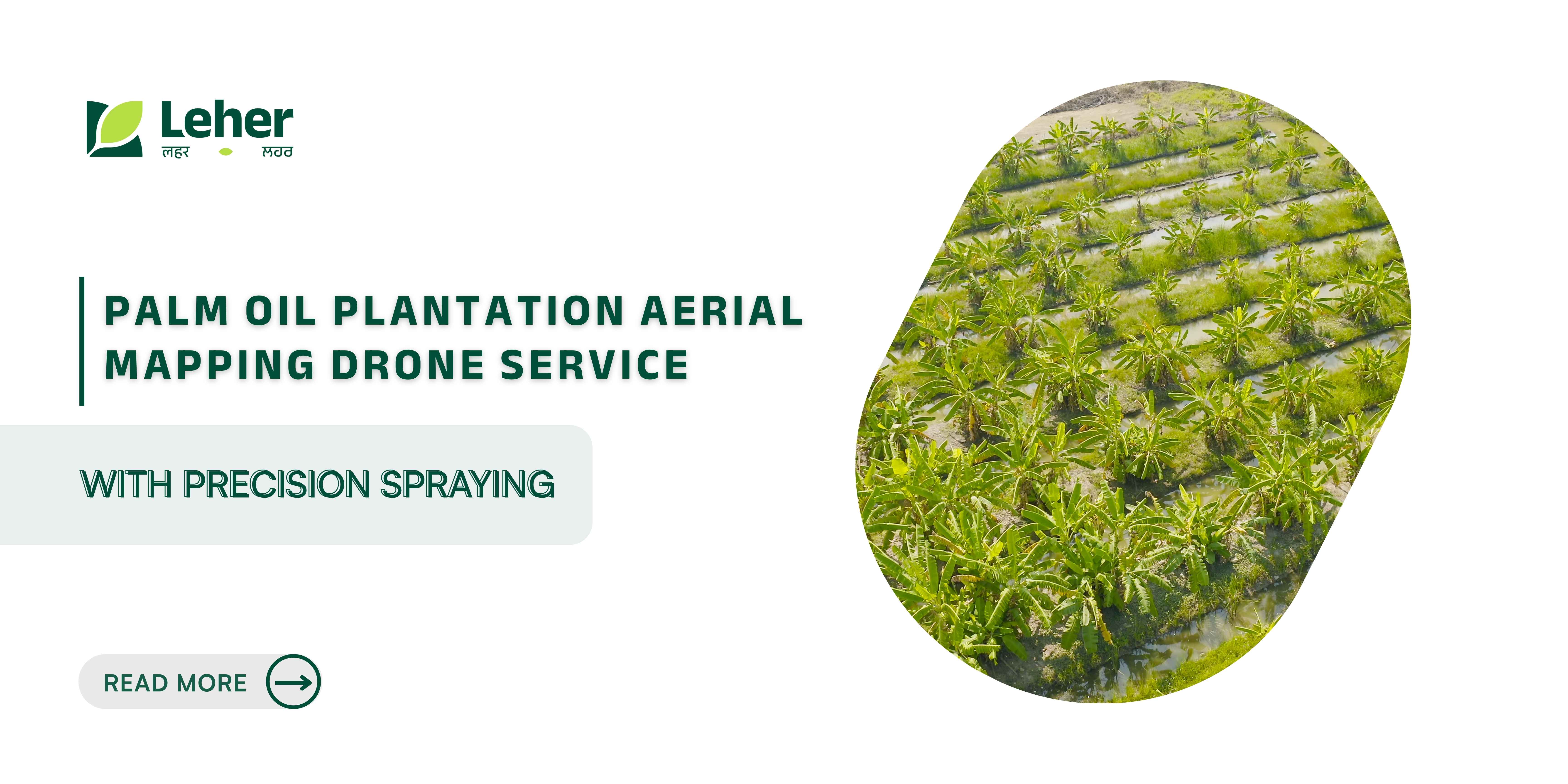
Palm Oil Plantation Aerial Mapping Drone Service with Precision Spraying
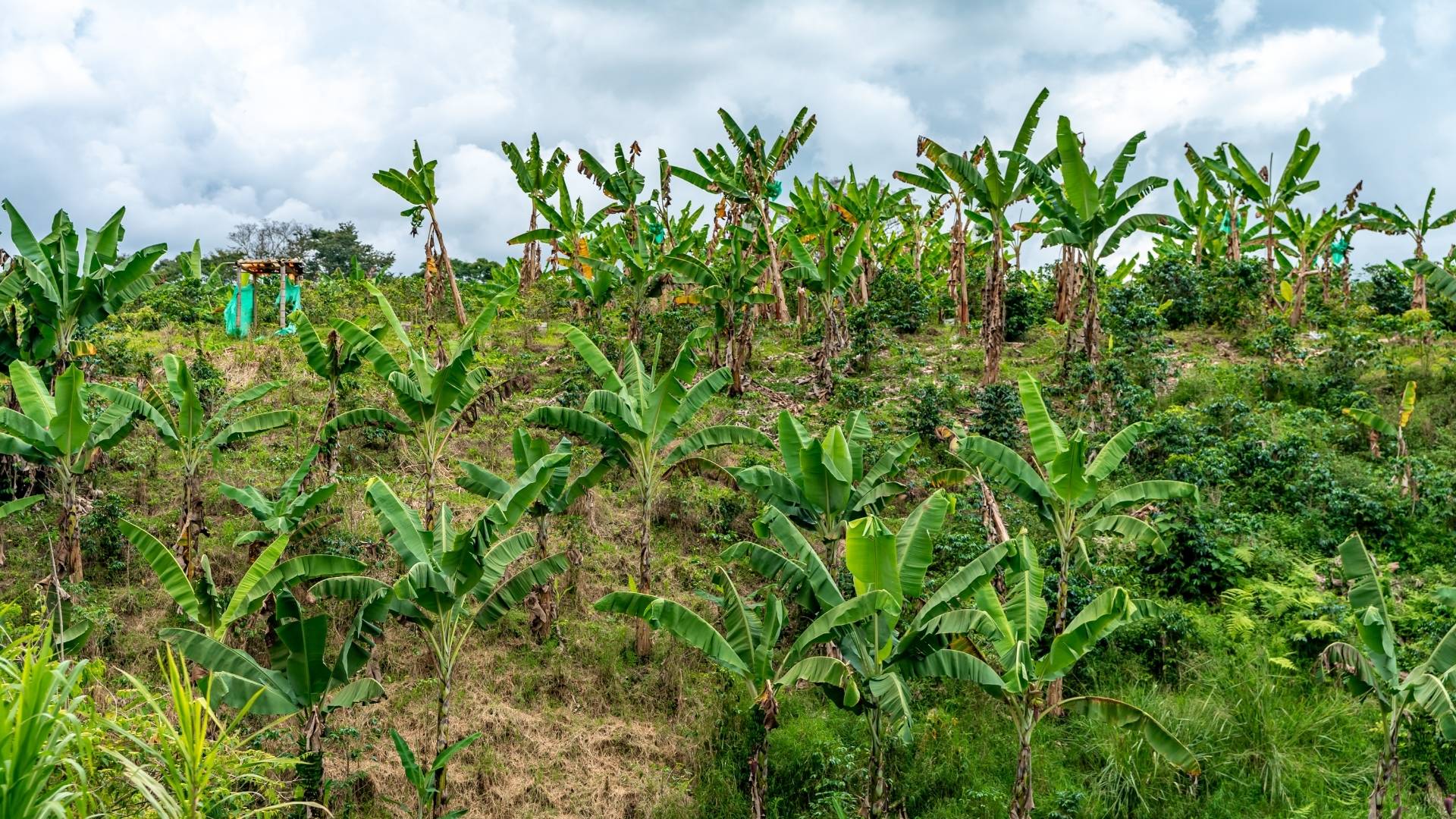
In 2025, India still imports around 16 million tonnes of edible oils annually, with 9-10 million tonnes of palm oil coming from other countries to meet domestic demand. This heavy reliance increases pressure on plantation owners to raise productivity while carefully managing labour, water, fertiliser, and pesticide use.
If you have spent long hours walking across acres, trying to detect stressed palms or manually fix uneven spraying, you know how exhausting and slow this process can be. Many farmers and plantation managers face delays, uneven crop health checks, and wasted resources that reduce yield and increase costs.
In this blog, you’ll learn how aerial mapping drones provide precise field insights, help spot issues earlier, and support smarter decisions for better palm oil yields and more efficient resource use.
Key Takeaways
Time-Saving Inspections: Drones survey large areas in minutes, replacing days of manual inspections.
Early Problem Detection: High-resolution mapping identifies stressed palms, pests, and nutrient gaps before visible damage.
Resource Efficiency: Prescription maps ensure precise use of water, fertilisers, and pesticides, reducing waste and costs.
Better Planning & Forecasting: Accurate 3D models and crop counts support yield estimation and plantation management.
Actionable Data with Safety: Leher drones combine advanced technology, certified pilots, and data-driven insights to improve operations.
What is Palm Oil Plantation Aerial Mapping Drone Service?
Aerial mapping drone services use drones to capture high-resolution images of palm oil plantations. These images are processed into actionable maps and models, allowing farmers to understand crop health, detect stress, and plan interventions. Here are the core functions these drones perform during a mapping mission;
High-resolution Imagery Capture: Drones fly over the plantation and take detailed photographs, covering every area precisely.
Generation of Orthomosaics and 3D Models: The images are stitched into comprehensive maps and 3D representations of the plantation. These models show plant spacing, height variations, and areas requiring attention.
Replacement or Augmentation of Traditional Ground Surveys: Instead of walking through each section, drones quickly gather data, saving time and reducing human error.
These capabilities ensure that every palm is accounted for, and plantation managers can make data-backed decisions without relying solely on manual inspection. The maps also help plan fertiliser and pesticide applications with greater precision.
Now that we understand what aerial mapping drones do, let’s look at the common challenges in palm oil plantations that make these solutions necessary.
Hidden Struggles Behind Palm Oil Plantations
Palm oil cultivation faces several recurring problems that affect productivity and resource use. Identifying these challenges helps in understanding why drone mapping is so valuable.
Labour Shortages: Large plantations need skilled workers for inspection, spraying, and maintenance. Finding trained staff is difficult, slowing operations and increasing costs.
Inefficient Manual Spraying: Hand-applied fertilisers and pesticides are uneven and time-consuming. Some palms may be overtreated while others remain untreated, wasting resources and harming productivity.
Low Crop Yield & Soil Depletion: Without precise monitoring, stressed or diseased palms often go unnoticed. Over time, soil fertility declines, impacting long-term yield and food security.
Resource Wastage & Environmental Pressures: Excess water, chemicals, and fertilisers increase costs and harm the environment. Climate change and unsustainable practices amplify these pressures, making precise resource management critical.
Marginal Environment Limitations: Many plantations operate in areas with challenging soils, temperature extremes, or scarce water. Over- or under-irrigation and uneven nutrient application reduce productivity and efficiency.
Delayed Disease Detection: Early signs of stress, pests, or disease may go unnoticed. Without timely intervention, these issues spread quickly, reducing overall harvest and increasing costs.
These challenges show why modern drone technology is becoming indispensable. By providing fast, precise, and data-driven insights, drones help farmers identify stressed palms, optimise water and fertiliser use, and improve both productivity and sustainability.
Want to overcome these challenges and move to faster, more precise spraying on your plantation? Join Leher’s Drone Partner Program or book a drone spray directly through the Leher App on Google Play or the App Store.
Also Read: How Drones Are Revolutionising Agriculture Practices
Now that you know the problems most plantation owners face, let us look at how drone technology helps solve them.
How Palm Oil Drone Services Work: 6 Simple Steps
Aerial mapping drones follow a systematic process to gather precise data and support actionable decisions on palm oil plantations. Modern drones go beyond basic mapping to provide insights that improve crop health, resource management, and yield forecasting. Here is how the full drone mapping process works on your plantation:
Step 1: Flight Planning and GPS Mapping
Before take-off, the plantation boundaries are mapped using GPS coordinates. This ensures complete coverage and sets the optimal flight paths for high-resolution image capture.
Defines exact plantation boundaries.
Plans the most efficient route for complete data capture.
Sets flight altitude and speed for accurate image quality.
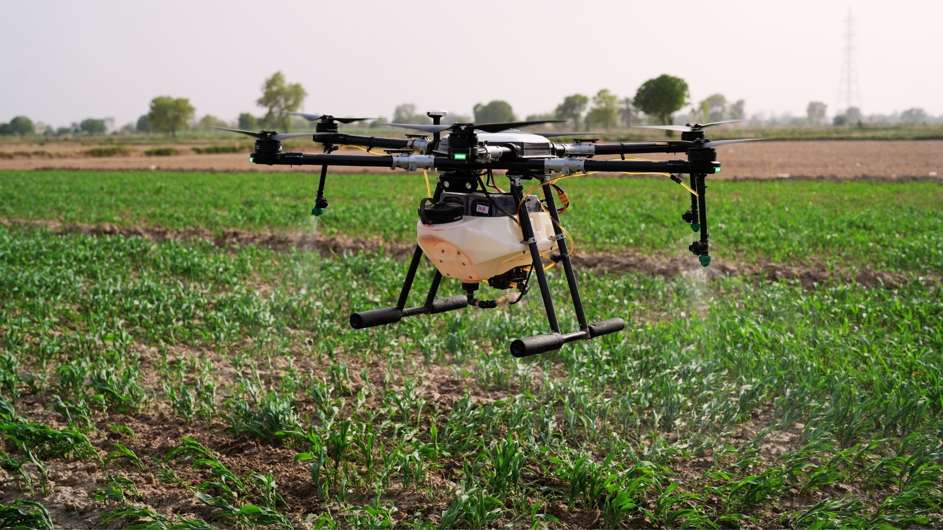
Step 2: Capturing High-Resolution Images
Drones are equipped with cameras and multispectral sensors to capture detailed photographs of every palm, trunk, and surrounding soil.
Highlights stressed palms or disease-prone areas.
Captures images for orthomosaics and 3D models.
Provides data for analysis of crop spacing and canopy coverage.
Step 3: Terrain and Soil NDVI Mapping
Drones use NDVI (Normalized Difference Vegetation Index) and other indices to quickly assess soil and terrain conditions.
Soil Analysis: Measures salinity, nutrient content, and moisture levels.
3D Mapping: Generates 3D elevation maps to guide planting and irrigation planning.
Seasonal Monitoring: Tracks soil health across seasons for targeted interventions.
Step 4: Monitoring Crop Health
Advanced drone sensors monitor key environmental conditions that affect palm growth.
Measures temperature (thermal) and light reflectance. Humidity requires ground-based sensors for accurate measurement.
Identifies signs of disease or pest damage at an early stage.
Enables precise irrigation, nutrient application, and other corrective measures.
Step 5: Prescription Maps for Fertilisers, Herbicides, and Pesticides
Drones create plant-specific maps for spraying, ensuring resources are applied only where needed.
Avoids overuse of water, fertilisers, and pesticides.
Protects healthy palms from unnecessary chemicals.
Saves costs while improving environmental sustainability.
Step 6: Crop Assessment, Plant Population Counting, & Land Classification
After capturing all data, drones provide a comprehensive overview of the plantation, enabling better planning and yield management.
Drones detect stressed palms, evaluate growth, and measure the efficiency of any ongoing treatments.
They count palms across the plantation to estimate expected yield and monitor survival rates.
The technology identifies arable, mixed, or pastoral areas and tracks changes over time to maintain accurate records.
Frequent drone updates enable managers to implement timely interventions and optimise resource allocation.
With Leher drone spraying, you can save up to 90% on water, 40% on inputs, and 20% on overall costs through precise spraying and GPS-guided targeting. Book your first session today and start improving your plantation’s efficiency.
Also Read: Profitable Drone Business Ideas for 2025
With all six steps completed, plantation managers gain precise, actionable data. Let’s now look at the direct benefits of using drone mapping services.
Benefits of Drone Mapping for Palm Oil Plantations
Drones address multiple pain points for palm oil farmers, helping save time, reduce resource wastage, and improve overall yield. Their data-driven insights allow managers to make better decisions quickly.
Time and Labour Savings: Drones can survey large areas in minutes rather than days, drastically reducing the effort needed for field inspections. Early detection of stressed palms allows plantation managers to act promptly and avoid potential losses.
Resource Optimisation: Prescription maps ensure fertilisers, pesticides, and water are applied only where they are needed. Soil NDVI and moisture mapping prevent unnecessary input use, reducing costs while protecting the environment.
Data-Driven Decision Making: High-resolution orthomosaics and 3D models provide a complete view of the plantation. Crop counts and growth tracking support accurate yield estimates and allow managers to make informed decisions throughout the season.
Crop Health and Yield Improvement: Timely interventions improve palm health and productivity. Pests, diseases, or stress factors are identified early, ensuring consistent and higher yields across the plantation.
Compliance and Record Keeping: Automated land and crop classification ensures plantation records are accurate and up-to-date. Tracking changes over time supports better planning, regulatory compliance, and guides decisions for future seasons.
Environmental Sustainability: Precise drone applications reduce the overuse of chemicals, protecting soil and water resources. Efficient water and input management lowers waste and reduces the plantation’s overall carbon footprint.
Managing a palm oil plantation manually takes hours, but Leher’s aerial-mapping drones provide precise insights in minutes, saving time and improving yield. Contact us to learn more about how drone mapping can simplify your plantation management and support higher yields.
With these clear advantages, let’s explore how Leher applies drone technology to deliver real, measurable results for farmers and plantation managers.
How Leher is Delivering Real Impact Through Drone Technology
Leher is reshaping Indian agriculture by turning cutting-edge drone advancements into practical, on-ground results for farmers and rural entrepreneurs. With a mission to make spraying faster, safer, and more cost-effective, Leher combines smart technology with an approach that prioritises farmers’ needs and maximises their benefits.
Here’s how Leher creates real impact:
Proven Scale and Reach: Leher has already sprayed over 35,000 acres across India, partnering with 2,200+ drone operators to serve smallholder farmers, cooperatives, and estates.
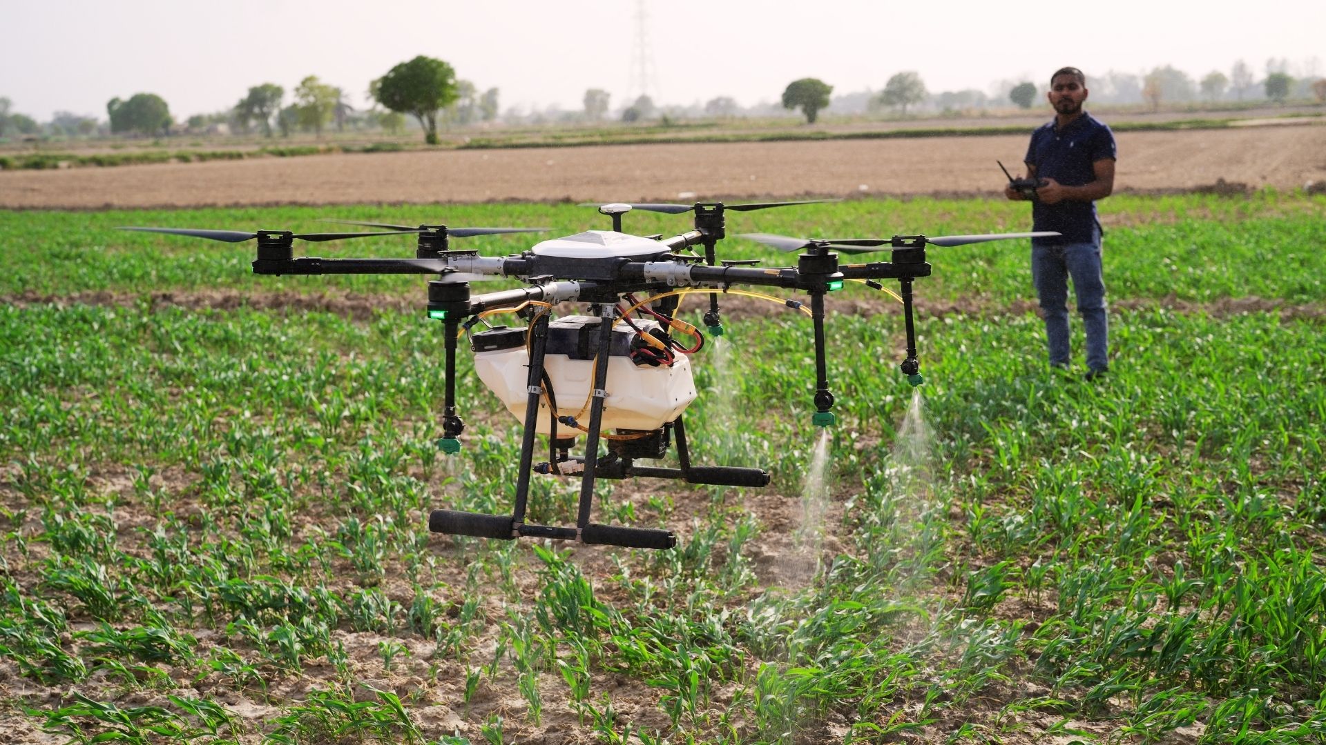
Fast and Efficient Spraying: Each drone can spray up to 50 acres a day, with a 10-litre tank, 22-minute flight time, and a 45-minute recharge time. Spraying takes minutes, not hours.
Lower Chemical Use, Better Results: Farmers using Leher’s drones report up to 75% less chemical residue and 30–50% yield improvements, especially in crops like tea, rubber, and horticulture.
Easy Access Through Mobile Booking: Farmers can book services through the Leher app, WhatsApp, or a centralised call system. Trained, DGCA-certified pilots handle the spraying, and payment is collected only after the job is complete.
Support for Drone Entrepreneurs: Leher empowers rural youth to become drone service providers. Its partner program includes training, financial assistance, and an app to manage daily operations, orders, and payments.
Data-Backed Decision-Making: Every spray is logged through Leher’s Spray Management System. Farmers receive GPS flight paths, chemical usage logs, and auto-generated reports to support subsidy applications and planning.
Download the Leher app today (Google Play, Apple Store) or join our Drone Partner Program to experience a plantation that is faster, more sustainable, and clearly more profitable.
FAQs
1. Can aerial mapping drones detect early signs of nutrient deficiencies in palms?
Yes. Drones with multispectral sensors detect stressed palms and nutrient gaps before visible symptoms appear, allowing you to target fertiliser applications precisely, improving palm health and preventing yield losses efficiently.
2. How often should a palm oil plantation be surveyed with drones?
Ideally, every 2-4 weeks during active growth seasons. Regular surveys ensure early detection of stress, disease, or irrigation issues, enabling timely interventions and optimised resource use for maximum yield.
3. Are drone mapping services suitable for small plantations under 7 acres?
Yes. Even small plantations benefit from precise monitoring. Drones save time, highlight stressed palms, and ensure correct spraying of water, fertilisers, and pesticides, reducing costs and preventing unnecessary chemical use.
4. Can drone data integrate with other farm management software?
Absolutely. Drone platforms allow exporting orthomosaics, 3D maps, and prescription data, enabling seamless integration of drone insights with existing farm management tools for planning, reporting, and record-keeping.
5. How safe is drone operation in large plantations with workers present?
Drones are operated by DGCA-certified pilots who follow strict safety protocols. Automated flight paths maintain safe distances from workers while accurately and efficiently covering large areas.
Let’s Grow Together!
Interested in drone spraying solutions? Connect with us today.