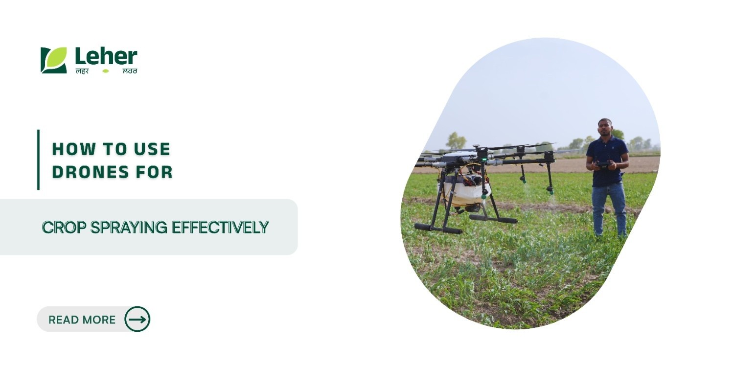
How to Use Drones for Crop Spraying Effectively
Your crops need spraying, but traditional methods are falling short. Manual spraying exposes workers to chemicals for hours, while tractors compact soil, damage young plants, and stall in waterlogged fields after monsoon rains. Drone spraying promises efficiency, yet technical complexity, regulations, and costs often feel like barriers.
Drone spraying also cuts chemical use by up to 20-30%. The impact is measurable. Conventional sprayers waste most of the chemicals through drift and uneven coverage, while prolonged manual spraying contributes to thousands of pesticide exposure cases each year. Rising labour costs and shrinking availability only add to the pressure during peak spray seasons.
Drone-based crop spraying addresses these challenges with GPS-guided precision, reducing chemical use by up to half and improving yield consistency through uniform application. The key lies not in owning a drone, but in using it correctly, starting with the right equipment, compliance, and field-ready execution.
Key Takeaways
Precision improves efficiency: Agricultural drones enable targeted spraying using GPS-guided flight paths, reducing overspray, runoff, and uneven chemical application compared to manual methods.
Operational efficiency at scale: Drone spraying allows faster coverage of farmland than manual backpack spraying, making it suitable for large plantations and time-sensitive crop treatments.
Reduced labour dependence: Drone operations significantly lower reliance on manual spraying, helping farmers manage labour constraints and reduce worker exposure to agrochemicals.
Access to difficult terrain: Drones can operate in slopes, wetlands, and narrow plots where tractors and ground equipment are impractical, avoiding soil compaction and crop damage.
Regulatory compliance is essential: In India, agricultural drone operations require DGCA-approved drones, pilot certification (RPC), registration on the Digital Sky platform, and use of pesticides approved by the Central Insecticides Board (CIB&RC).
Choosing the Right Drone for Your Farm
Selecting the wrong drone can waste money and limit what you can accomplish. Your farm size, crop types, and terrain determine which specifications matter most.
Match Drone to Farm Size and Crop Type
Small farms and fragmented plots: Compact agricultural drones are better suited for holdings under 10 acres, offering easier manoeuvrability in uneven fields and suitability for vegetables, pulses, oilseeds, and short-cycle crops.
Orchards and plantations: Tree-based crops such as fruits, coffee, and vineyards require drones with stable flight control and precise navigation to operate safely between rows and canopies without damaging plants.
Large farms and estates: Extensive farmland benefits from higher-capacity agricultural drones designed for longer operations and wider coverage, reducing turnaround time during spraying windows.
Indian operating conditions: Drones used in India must handle heat, humidity, and monsoon conditions. Locally designed or India-tested drones are often preferred due to durability, compatibility with approved inputs, and compliance with domestic regulations.
Advanced Navigation Features
RTK GPS ensures centimetre-level accuracy and eliminates overlap. Terrain-following radar maintains a consistent 2–3 meter spray height on uneven land, while LIDAR avoids obstacles like trees and poles. Breakpoint resume allows spraying to continue exactly where it stopped after battery changes.
Selecting drones with these features ensures accurate coverage, lower chemical costs, and reliable performance across real farming conditions.
Regulations and Legal Requirements
Operating drones commercially in India requires specific certifications and permits. Flying without proper documentation results in fines, equipment seizure, and potential criminal charges.
Aviation Rules and Licensing in India
The Directorate General of Civil Aviation(DGCA) mandates a Remote Pilot Certificate (RPC) for commercial operations. Training at DGCA-approved RPTOs takes 5-7 days, covering aviation rules, weather assessment, emergency procedures, and flight planning. As of July 2023, India has 63 authorised RPTOs that have certified over 5,500 pilots.
Digital Sky registration is mandatory for drones above 250 grams. You'll obtain a Unique Identification Number (UIN) and operator permit (UAOP) for commercial services. NPNT (No Permission, No Takeoff) compliance is enforced through firmware; your drone checks airspace status before each flight, preventing violations automatically.
Pesticide Application Permits
The Central Insecticides Board regulates which chemicals can be sprayed via drones. Only specifically approved formulations are legal for aerial application. Current approvals include registered pesticides, herbicides, fungicides, and nano urea. Crop-specific SOPs specify concentration ratios, spray volumes, weather conditions, and buffer zones.
Safety and Compliance Updates
No-fly zones include airports, military installations, and government buildings. Digital Sky maps these automatically. Flight logs are mandatory and subject to audits; records must include date, location, chemicals used, and weather conditions. The 2025 budget includes drone subsidies such as the Drone Didi (₹8 lakh operational funding) project.
Compliance protects your investment and builds trust with farmers who worry about chemical safety.
Field Mapping and Planning
Proper mapping and flight planning separate professional operators from amateurs. You'll apply exactly the right amount of chemical to each zone while avoiding overspray onto neighbouring properties.
Creating Digital Field Maps
Digital field mapping begins by recording farm boundaries using GPS-enabled tools, which can be uploaded into agricultural drone software. Survey drones equipped with imaging sensors capture visual and crop-health data that helps identify variations across the field. These maps are commonly used to flag areas showing signs of crop stress linked to pests, disease, or nutrient imbalance.
Segmenting fields based on crop condition allows farmers to apply inputs more precisely. Uniform areas receive standard treatment, while stressed zones can be addressed separately. This targeted approach supports more efficient input use and better crop management outcomes.
Designing Flight Paths
Flight paths are planned based on field shape and terrain. Regular fields typically use structured grid patterns to ensure consistent coverage, while irregular or sloped farms require adaptive paths that follow natural contours. Pre-programmed routes control altitude, turns, and spray zones, reducing dependence on manual piloting and improving consistency.
Reducing Drift and Overlap
Precision spraying relies on automated flow control and real-time monitoring to maintain consistent application rates. Sensors help regulate spray output and detect irregularities during operation, supporting accurate coverage while minimising drift, overlap, and unintended exposure beyond target areas.
Weather Monitoring for Optimal Spraying
Weather conditions determine whether chemicals land on target crops or drift onto neighbouring fields.
Ideal Weather Parameters
Weather conditions play a critical role in safe and effective agricultural drone spraying. Operations should only be conducted during calm conditions, as strong winds increase the risk of spray drift and unintended exposure to neighbouring crops, water bodies, or people. Early mornings and late afternoons are generally preferred, as air movement is lower and conditions are more stable.
Temperature and humidity also influence spray performance. Extremely high temperatures accelerate evaporation, reducing the amount of chemical that reaches crop surfaces. Moderate temperatures and balanced humidity help droplets remain effective long enough for proper leaf coverage and absorption. Very dry conditions can cause rapid drying, while excessive humidity may lead to runoff instead of absorption.
Avoiding Drift and Loss
Wind conditions should always be checked on-site before flight using basic weather instruments or approved monitoring tools. Maintaining consistent flight height and speed helps ensure even application across the field. Spray characteristics must be adjusted carefully, larger droplets reduce drift risk, while smaller droplets improve coverage but require calmer conditions.
Using appropriate nozzle settings, following label instructions, and operating only within recommended weather windows are essential to minimise drift, protect surrounding areas, and ensure compliance with Indian agricultural and aviation regulations.
Wet Field Advantages
Drones operate where tractors sink in muddy conditions. No soil compaction preserves root health. Treating slopes and narrow plots becomes simple, creating profitable niche markets.
Weather monitoring takes minutes but saves hours of wasted work and repeated applications.
Calibrating Spray Systems
Accurate calibration is the foundation of effective drone spraying. It ensures crops receive the right dose while minimising waste, drift, and chemical costs.
Nozzle Selection: Drift-reduction nozzles are recommended to improve spray accuracy, especially in open or windy fields. Nozzle choice should align with the type of application, fungicides, insecticides, or herbicides, and crop canopy structure. All nozzles should be replaced together when wear is detected to maintain uniform output across the spray system.
Optimising Flow Rate: Flow rate calibration should be performed before each spraying cycle. This involves filling the tank to a known level, running the pump for a fixed time interval, and measuring discharge to ensure consistency with manufacturer specifications. Low-volume spraying using drones allows targeted application while significantly reducing water handling and logistical effort compared to conventional ground spraying.
Variable-Rate Spraying: Advanced agricultural drones support variable-rate spraying, where onboard systems automatically adjust flow based on speed, altitude, and field conditions. When combined with crop health maps, this enables selective application, improving efficiency while avoiding overuse in healthy areas.
Calibration seems technical, but it is straightforward when you follow the manufacturer's procedures.
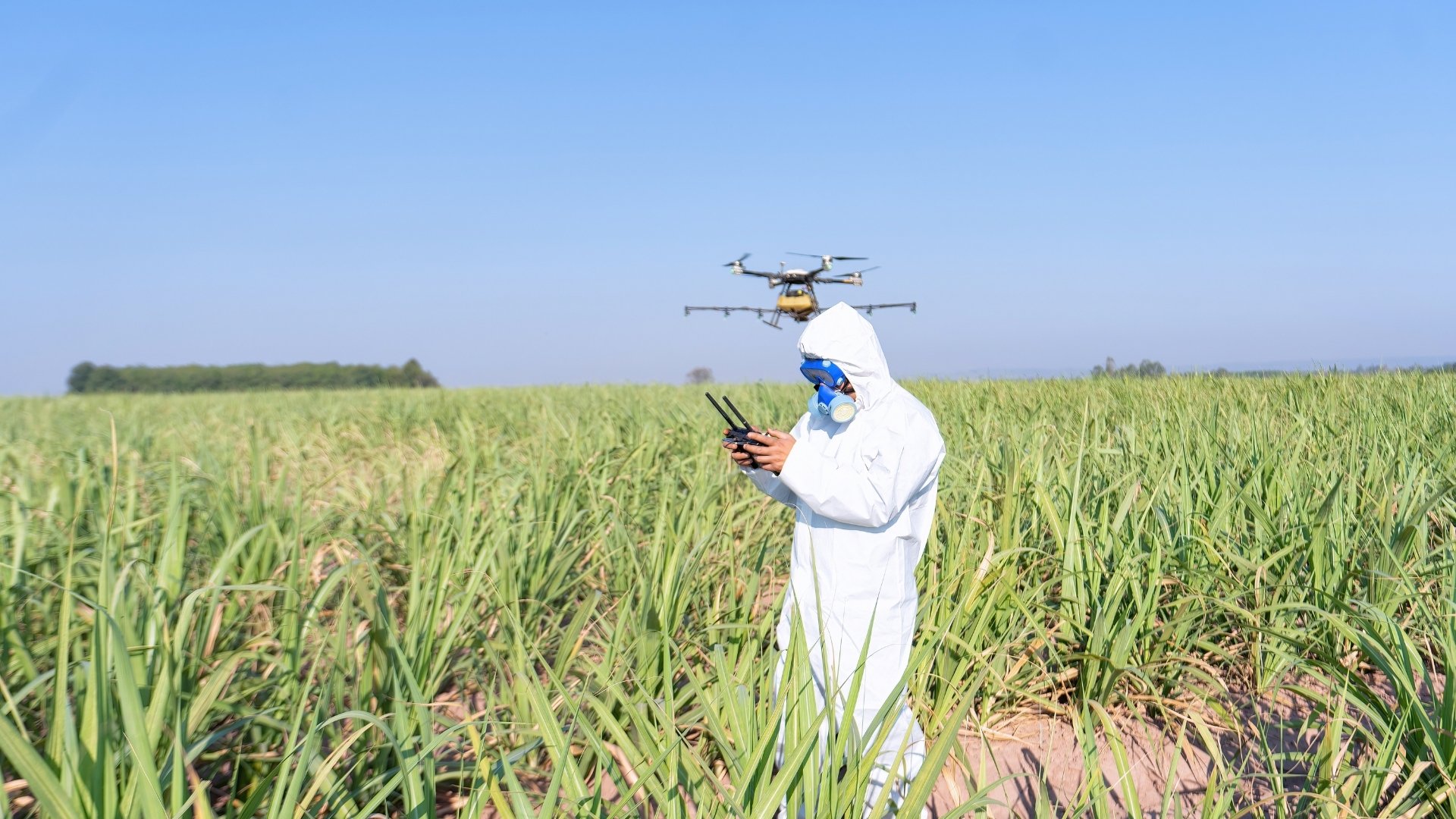
Chemical Handling Best Practices
Safe chemical handling is critical for operator health, cost control, and regulatory compliance. Using the right formulations and application methods ensures effective spraying without unnecessary exposure or waste.
Suitable Chemicals: Only use approved pesticides, herbicides, fungicides, water-soluble fertilisers, and nano urea designed for aerial application. Always confirm drone compatibility, as some formulations can foam, settle unevenly, or clog nozzles. Check expiry dates before use and store chemicals in cool, dry conditions to maintain stability.
Targeted Use Reduction: Precision mapping enables spot treatment rather than blanket spraying. NDVI-based targeting and variable-rate spraying allow chemicals to be applied only where crops need intervention, improving effectiveness while avoiding overuse. Soil and crop health data further refine application rates across different zones.
Minimising Operator Exposure: Closed filling systems reduce direct contact during mixing and loading. Operators should wear appropriate protective equipment during handling and preparation, even with drone-based spraying. Clear procedures, proper training, and careful cleanup after operations help maintain a safe working environment.
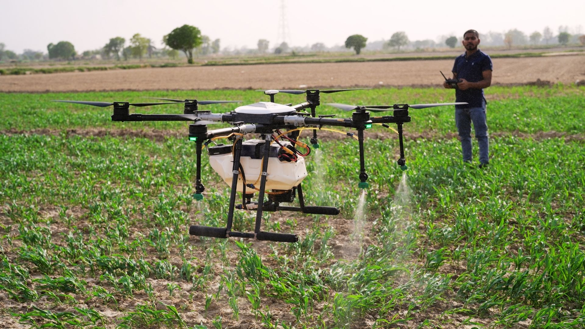
Optimising Altitude and Speed
Flight altitude and operating speed directly influence spray accuracy, canopy coverage, and drift control in agricultural drone operations. Maintaining consistent parameters ensures chemicals reach the intended crop surface while minimising loss and off-target exposure.
Ideal Spray Height: Drones should operate close to the crop canopy to ensure uniform distribution and effective penetration. Flying too high increases drift risk, while flying too low can lead to uneven application patterns. Modern agricultural drones use terrain-following sensors or radar systems to maintain consistent clearance across uneven fields, improving application accuracy on slopes and variable terrain.
Speed Balancing: Optimal flight speed depends on crop density and canopy structure. Dense crops require slower speeds to allow adequate penetration, while open or low-growing crops can be treated at higher speeds without compromising coverage. Most agricultural drone software automatically adjusts spray rates based on speed, reducing manual errors.
Sensor Monitoring: Integrated cameras and sensors help monitor spray performance during operations. Visual monitoring assists in identifying nozzle blockages or uneven spray patterns, while data collected before and after spraying supports assessment of coverage consistency. These systems help operators correct issues quickly and maintain compliance with approved spraying practices.
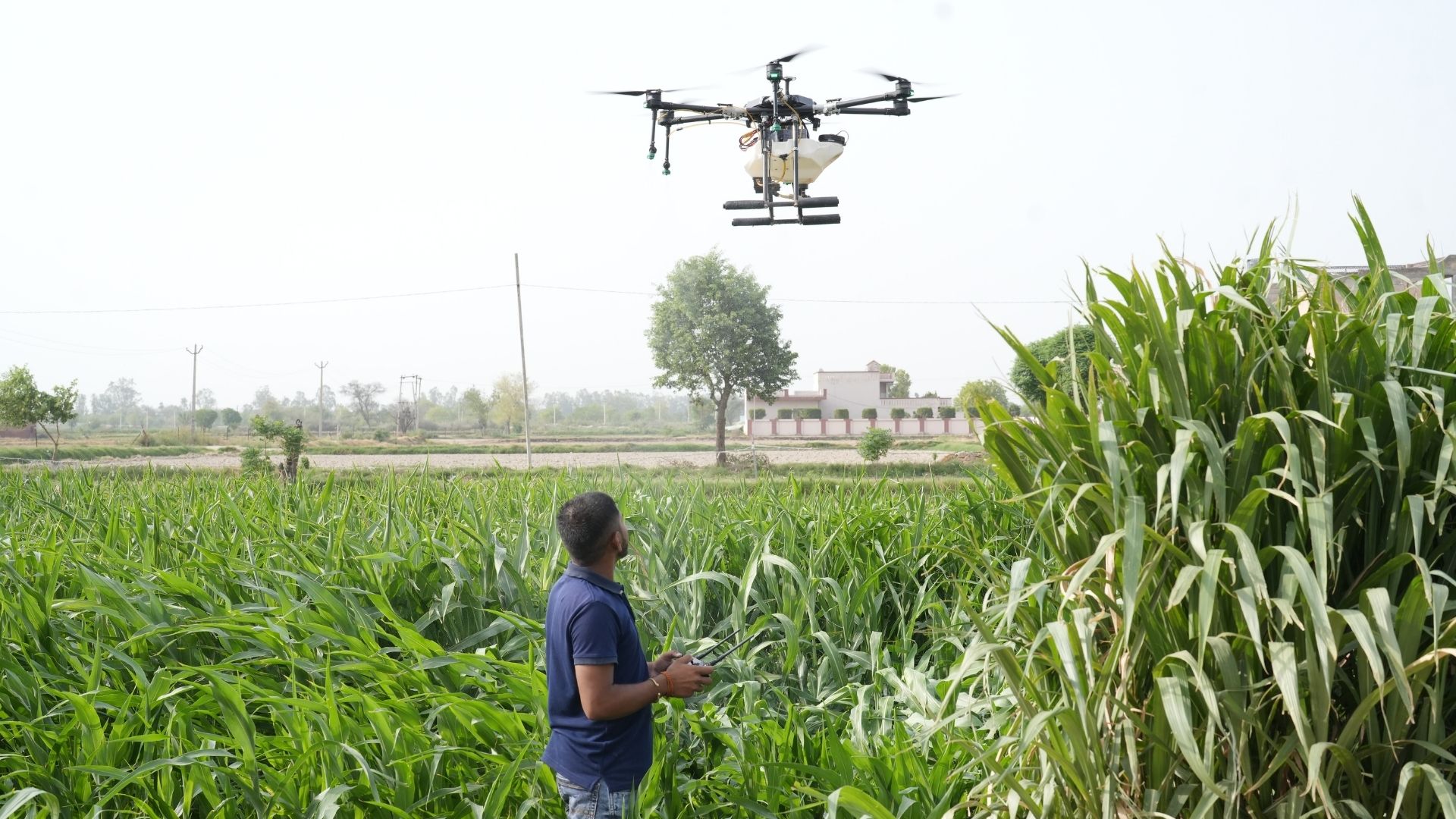
Executing Spray Missions
Well-executed spray missions turn planning into measurable field results. Precision deployment ensures chemicals reach the right areas without damaging crops or wasting inputs.
Launching Operations: Spray missions are executed by uploading pre-defined flight and spray plans into the drone manufacturer’s control application. Operators can choose between full-field coverage, zonal application, or targeted spot spraying based on crop condition and advisory inputs. This approach allows differentiated treatment across a single field rather than uniform application.
Protecting Crops: Drone-based spraying avoids physical contact with crops and soil. Unlike ground-based machinery, aerial application eliminates soil compaction and mechanical crop damage, preserving root structure and plant integrity. This makes drones particularly suitable for mature crops, dense canopies, and fields where ground access could cause harm.
Treating Difficult Areas: Agricultural drones enable safe spraying in areas that are difficult or unsafe for manual or tractor-based operations. These include waterlogged fields, uneven terrain, narrow field sections, and elevated or sloped plantations. Remote operation reduces operator exposure and allows treatment of plots that would otherwise remain untreated.
Post-Spray Analysis and Integration
Spray operations are most effective when outcomes are monitored and used to refine future applications. Post-spray analysis enables farmers and agribusinesses to verify coverage quality, assess crop response, and improve decision-making over time.
Reviewing Flight Data: Agricultural drones generate detailed flight logs that include GPS paths, application zones, and spray reports. These records help operators confirm that planned areas were covered and identify zones that may require adjustment in future missions. Reviewing historical flight data supports consistency and operational improvement across spray cycles.
Assessing Effectiveness: Crop response is typically evaluated through field inspections conducted several days after spraying to confirm pest control, disease suppression, or nutrient uptake. Where supported, remote sensing tools such as vegetation indices can be used to observe changes in crop vigour over time. Maintaining small, untreated reference areas can help compare outcomes and guide future application strategies.
Farm Integration: Spray records can be integrated into digital farm management systems alongside weather data, crop calendars, and yield records. This enables long-term analysis of spray timing, frequency, and outcomes, supporting more informed decisions in subsequent seasons. Historical application maps also assist with planning crop rotation, input optimisation, and risk management.
Maintenance and Training
Consistent maintenance and skilled operators are what separate reliable drone operations from costly downtime. Proper care and continuous training extend equipment life, improve spray accuracy, and ensure regulatory compliance.
Routine Maintenance: Spray tanks, filters, and nozzles should be cleaned after every use to prevent residue buildup. Batteries, propellers, motors, and airframes must be inspected regularly for wear or damage, with timely replacement of faulty components. Periodic professional inspections help identify structural or electrical issues early.
Firmware Updates: Manufacturers release firmware updates to enhance safety, performance, and regulatory alignment. Applying approved updates on time and testing systems before flights helps prevent operational errors.
Training: Pilots must hold a DGCA-issued Remote Pilot Certificate (RPC) and complete training covering airspace rules, weather assessment, emergency procedures, and spray calibration. Ongoing refresher training ensures operators remain compliant as technology and regulations evolve.
How Leher Helps Farmers Use Drone Spraying Effectively
Using drones successfully requires more than equipment, it needs trained pilots, compliance, and reliable execution. Leher delivers a full-stack UAV spraying ecosystem built for Indian farming conditions.
End-to-End Drone Spraying Access: Farmers can book certified drone spraying without owning drones or managing regulations. Leher provides trained pilots, DGCA-compliant operations, and field-ready execution across row crops, plantations, wetlands, and uneven terrain. Bookings are available via the Leher app or WhatsApp for easy rural access.
Technology-Driven, Proven at Scale: Leher’s drones operate across thousands of acres and diverse crop types. Every mission is tracked through Leher’s Spray Management System (SMS), capturing spray volume, chemical usage, flight logs, and battery data for accuracy and transparency.
Supporting Local Drone Entrepreneurs: Through the Drone Partner Program, Leher enables rural entrepreneurs to run profitable drone spraying businesses. Partners receive access to drones, training, certification support, orders, and performance dashboards, without handling customer acquisition or complex operations.
A Platform, Not a One-Off Service: Leher combines company-owned drones, franchise pilots, and proprietary software to deliver consistent spray quality, faster turnaround, and scalable precision agriculture.
Explore Leher's Drone Partner Programme and start earning from drone spraying without buying equipment. Connect with farmers needing services while we handle training, certification support, and booking management. Book a free demo call today.
Download the Leher App (Google Play, Apple Store) or join the Drone Partner Program to build your agri business.
FAQs
1. Can drones spray all types of crops effectively?
Yes. Drones handle rice, wheat, cotton, sugarcane, vegetables, fruits, and plantation crops. Nozzle type and droplet size are adjusted for canopy density, with terrain-following for tall crops and low-altitude stability for shorter crops. Multi-rotor drones work especially well in orchards.
2. How much does drone spraying cost compared to traditional methods?
Drone spraying is typically priced per acre and becomes cost-effective through reduced chemical use, lower crop damage, and faster coverage. Service-based models eliminate the need for high upfront investment in equipment and training.
3. What happens if a drone malfunctions during spraying?
Most agricultural drones have built-in safety features such as auto-hover, return-to-home, and resume-from-breakpoint. If a flight is interrupted, spraying continues from the exact stop point once operations resume.
4. Do I need to own a drone, or can I rent services?
Both options are available. Large farms with frequent spraying may benefit from ownership, while small and medium farms often prefer renting services to avoid purchase, maintenance, and pilot certification costs.
5. How long does it take to become a certified drone pilot in India?
DGCA-certified training typically takes about a week at approved training organisations, covering theory and practical flying. Certification is issued after successful completion and remains valid for several years.
Let’s Grow Together!
Interested in drone spraying solutions? Connect with us today.